Hiking tips
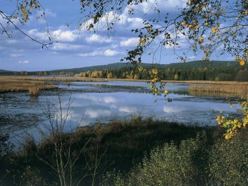
Šumava (Boletice)
Trail to Knížecí Stolec (14 km)
The trail surpassing four hundred meters of altitude will reward you with the view that has no rival in the entire Český Krumlov region – you will see the entire Šumava borderlands, and, with good visibility, even the distant Alps. It is the trail to Knížecí Stolec in the military district of Boletice, which is open to the public on weekends and holidays. However, one must strictly follow a marked trail leading across the military training territory.
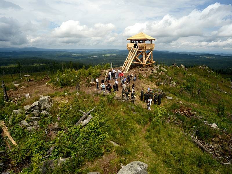
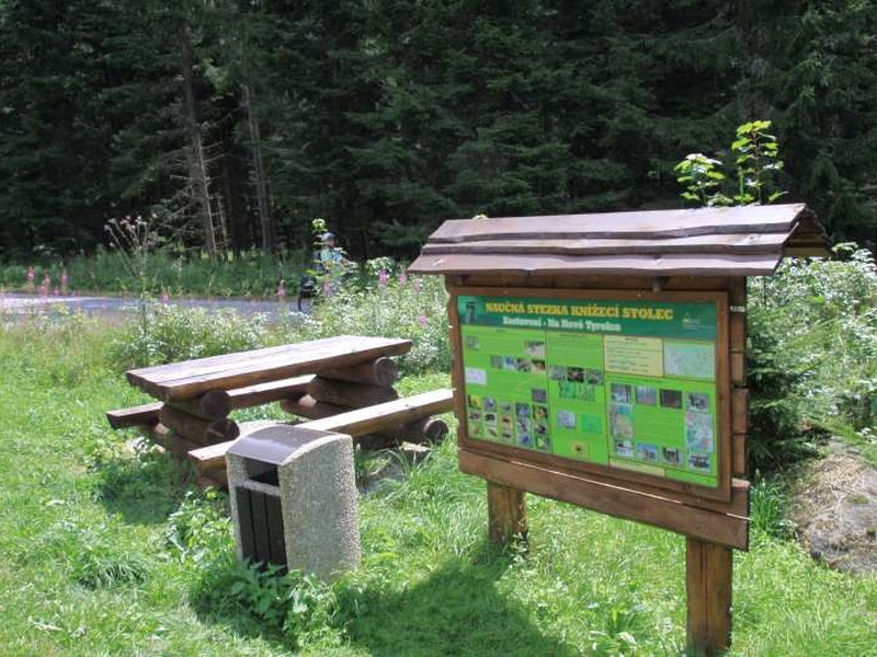
The trail starts on the boundary of the military district near the Schwarzenberg gamekeeper’s lodge in Uhlíkov nad Záhvozdím, only a short way from the main road from Horní Planá to Veltrusy, across the valley of the upper reaches of Vltava. The blue hiking mark goes up across the valley of Uhlíkovský Creek and runs on hard roads, mainly across the woods. Directly at the car park, you can find an educational trail board, which is part of the trail. From this point, the trail continues to Adolfův Rock and then to Knížecí Stolec between various rock formations. Along the last few hundred meters toward the peak of the 1,236-meter-high hill, there is a steep rise on a bare slope, which is a consequence of the Kyrill Windstorm. It caused that Knížecí Stolec and its surroundings are not afforested, which paradoxically opens an unusual panoramic view of the surroundings from its peak, which is even enhanced by a six-meter wooden observation tower built by Vojenské lesy a statky.
From the peak, the blue mark runs down a rocky path toward the crossroads of Skalka and a sheltered resting place with another information board. The track then goes downwards to the periphery of the Boletice military district. It ends at the place where you started your trek – at the Uhlíkov gamekeeper’s lodge.
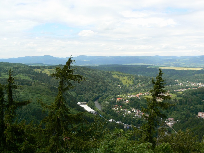
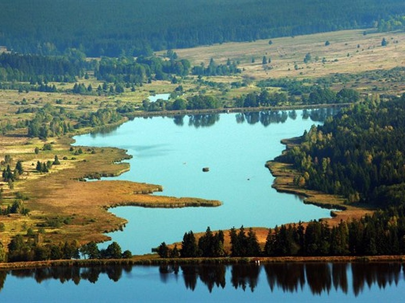
Track around Špičák – the track with views
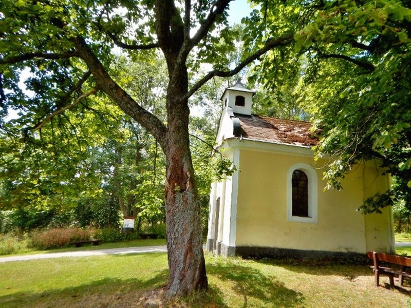
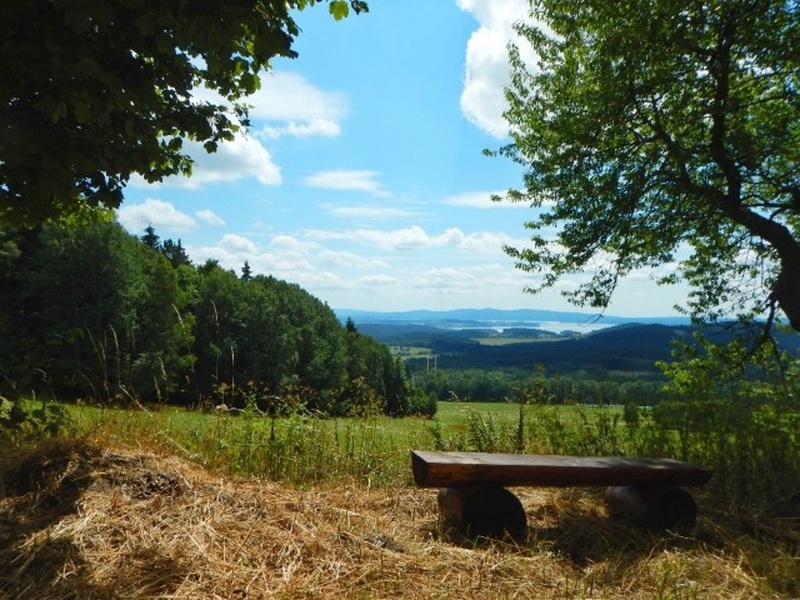
The twelve-kilometre weekend hiking trail around the 1,221-meter-high peak of Špičák at Horní Planá is a track of views of the landscape in the Lipno surroundings. Therefore, Vojenské lesy a statky built nine benches there, so that visitors can sit down and enjoy the view of the surroundings along their way. The blue marked hiking trail runs on the trail of Maňávka – Stará Huť – Liščí Rock – Vlčí Rock – Kapradinec – Maňávka. On the eastern part of the track, there are benches with a far-reaching view of meadows, forests and the Lipno Dam, two of them being located at a chapel in the place of the former glass settlement of Stará Huť. The seventh bench serves for relaxation near Liščí Rock, and the last two benches are located at the Špičák hunting lodge.
The whole hiking trail runs mainly across spruce forests on hard roads, but with quite demanding rises in some places.
The VLS recreational facility at the Olšina pond, where a restaurant, car park and the Hodňov railway stop can be found, is an ideal starting point of the trail. From Hodňov, you can get to the trail leading around Špičák on the red trail toward the Maňávka crossroads. Alternatively, however, you can choose Horní Planá as the starting point.
The trail around Špičák is open to the public on weekends and national holidays from 7 a.m. to 9 p.m. The time limitation is necessary due to military training activity.
Brdy
Track to Padrťské Ponds
Two ponds at a former village on the plateau are one of the most interesting tourist destinations of the Brdy military district. These unique bodies of water can be visited by foot or by bike; visitors can admire the almost virgin nature around Hořejší and Dolejší Padrťský Pond.
The village of Teslíny on the road between Rožmitál pod Třemšínem and Spálené poříčí is the best starting point, from where you can walk or ride a bike on cycling trail no. 2275 two kilometres upwards to the crossroads with trail no. 2273. Then you turn left to the dam of Hořejší Padrťský Pond. The cycleway then continues around the Maria Theresa rock over the Okrouhlík hill to the village of Trokavec.
Around Hořejší Padrťský Pond, visitors are free to enter the woods. This area has almost seventeen thousand square kilometres and is connected southwards to the accessible cycling trail.
Thanks to the long-term elimination of intensive human activity, the region of Padrťské Ponds is a unique locality with many protected animals and plants. It is the home of the white-tailed eagle; the locality is used by the osprey during migration; the common kingfisher and the European otter can be found here too. In the surroundings, you can see the black stork as well as the grey heron. Padrťský Creek is the home of the European crayfish. Both ponds serve as the source of drinking water for the Rokycany region, and, along with their surroundings, they form a unique natural locality, which has no parallel far and wide.
With regards to military training, the trails are open on weekends and holidays; however, from 1 January 2016, following the cancellation of the Brdy military district, they will be accessible without this limitation.
Oderské Uplands (Libavá)
Toward the source of the Odra River
The military district of Libavá in Oderské Uplands is the springhead of one of the two European rivers in the Czech Republic. While the Krkonoše source of the first one, Labe, is one of the most frequented tourist destinations, the Odra River does not arouse so much interest.
The place of the river’s source can be reached by the trail marked in red from the bus stop in the village of Dolní Újezd at Lipník nad Bečvou. The trip by car up to the village of Kozlov in the military district is a shorter option, where you can park your car on a car park near the barracks and start the track only a few hundred meters from the source. The source rises on a peat meadow surrounded by spruce forests in a shallow saddle at an altitude of 633 m between Křížová Mountain and Fidlův Hill.
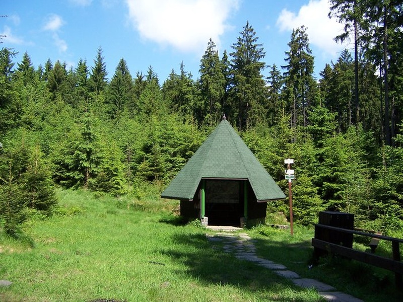
In the place of the source, there is a small wooden shelter with benches, serving as shelter from bad weather, which is frequent in the local, rather harsh climate (the average annual temperature is 6 degrees; the annual precipitation amount is 800 mm). It is interesting that this place was declared the source of the Odra as late as in 1715. Other localities had been assumed to be the beginning of the large river before
The trail has been accessible since 1991; however, on weekends and holidays only. This limitation must be observed, as there is intensive military training of the Czech Armed Forces and other NATO troops.
Doupovské Mountains (Karlovy Vary region)
Bučina observation tower
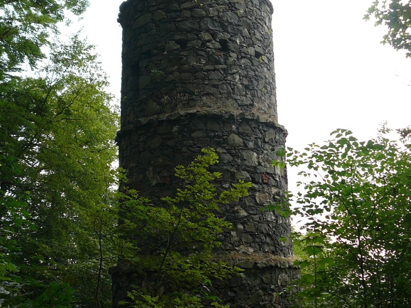
The steep climb from the valley of the Ohře River from the dilapidated spa of Kysilka at Karlovy Vary to one of the oldest observation towers in the Czech Republic will reward you with a unique view of the surroundings of the Western Bohemian metropolis, the river valley, Doupovské Mountains and Krušné Mountains.
The ten-meter-high stone observation tower was built in 1880 at an altitude of 582 meters by the famous local native and businessman Heinrich Mattoni.
Ralsko
National Nature Reserve of Břehyně-Pecopala
The national nature reserve of Břehyně-Pecopala in Ralsko is the territory of hundreds of sandstone ravines and dales, the home of a pack of wild wolves, as well as many other animal species. The unique natural area is part of the Bezděz forestry park, which is a sample joint project of Vojenské lesy a statky ČR, Lesy ČR and local municipalities and villages, showing the ideal symbiosis of nature conservation interests and sustainable forestry to the public.
Out of dozens of kilometres of cycling and hiking trails leading across this former military district, we recommend the red Hradčany trail. The village of Hradčany is an ideal starting point, where you can park your car on the car park at the Information Centre of Vojenské lesy a statky.
Starting on the red mark of the local VLS track under Havraní Rock, turn left after about one kilometre and continue across Kraví Gorge to the crossroads of hiking marks at U Kukačky. Keep on the left toward Měděný Mine and, across Uhelná Gorge at the U Hvězdy crossroads, climb on Popelový Range, which is located on the territory of the national nature reserve. Then you climb down the hill back to Uhelná Gorge and cross the road to Doksy at the Trojzubec gamekeeper’s lodge. Behind the road, continue on a forest path toward the nature reserve of Hradčanské rybníky. Before Držník Pond, turn left to a road, which will lead you back to Hradčany
The ten-kilometre trail leads mainly across flatland. One of its advantages is that you can combine the trip with an alternative trail of the Jeřáb educational trail, mainly in the case of larger groups. The three-kilometre trail across Hradčanské Walls also starts and ends at the VLS Information Centre and is suitable for little children as well. If the little hikers need to wait for travellers making the longer red track, they can visit the exposition at the Information Centre or the nearby pound for handicapped animals called “Minizoo Osamělá hvězda,” which is operated with the support of VLS ČR.
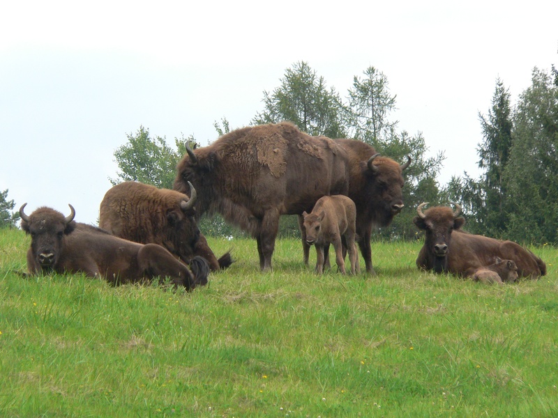
Go to see bison in the Židlov game park
The name of this hiking tip is rather a euphemism, as you need to be very lucky to see the only herd of wild European bison in the Czech Republic during your visit to Židlov. However, the second largest game park in the country, managed by Vojenské lesy a statky ČR, which has been implementing the unique programme of returning the European bison back to the wild here, is worth seeing itself. Unlike many other similar breeding facilities, it is open to the public, but visitors must only follow marked asphalt or hard trails in the game park.
If you want to visit Židlov, we recommend using the VLS cycling trail, which starts at the VLS gamekeeper’s lodge in Skelná Huť, where you can park your car. The forest turning to Skelná Huť can be found between the villages of Kuřívody and Ploužnice on the main road of Mnichovo Hradiště – Mimoň.
The cycling trail will lead you to Ploužnický Pond, where you will turn right to continue on cycling trail no. 241 leading to the Židlov game park. In the game park, you can use cycling trails no. 241 or 25. In addition to the same track you used, you can return back along two main roads. The shorter one is a cycling trail to Kuřívody with the three-kilometre ride on the main road to Skelná Huť. A much longer, but more attractive, trail runs around the game park across Čertova Wall and the Stohánek crossroads at the ruins of the castle of the same name to cycling trail no. 3046. Then, at Nový Dvůr, you will turn to the VLS cycling trail, which will lead you back to Skelná Huť.
There is little chance that you will see bison on your trip, however, you are likely to meet some other inhabitants of the game park. These include deer, roe deer, mouflon, wild boar as well as fox. However, you will primarily enjoy the unique landscape of Ralsko.